Urban Rivanna River Corridor Plan
Project Summary
The Urban Rivanna River Corridor Plan is a joint effort between the City of Charlottesville and Albemarle County, along with other stakeholders, to develop a vision and action plan for the Rivanna River. This effort helps to refocus attention on the Rivanna. The planning process will help localities and stakeholders coordinate on making a cleaner, safer and more livable waterway that serves as a catalyst for community investment. The Thomas Jefferson Planning District facilitated this process through the existing conditions and visioning phases.
Vision Statement
The Rivanna River, flowing through Charlottesville and Albemarle County, is one of the community’s greatest assets. In and near Free Bridge, Woolen Mills, and the Pantops area, the river corridor is and will be a dynamic place where people can experience a natural environment, healthy outdoor activities and venues, peaceful and serene opportunities, and important historic and cultural points of interest.
The Plans
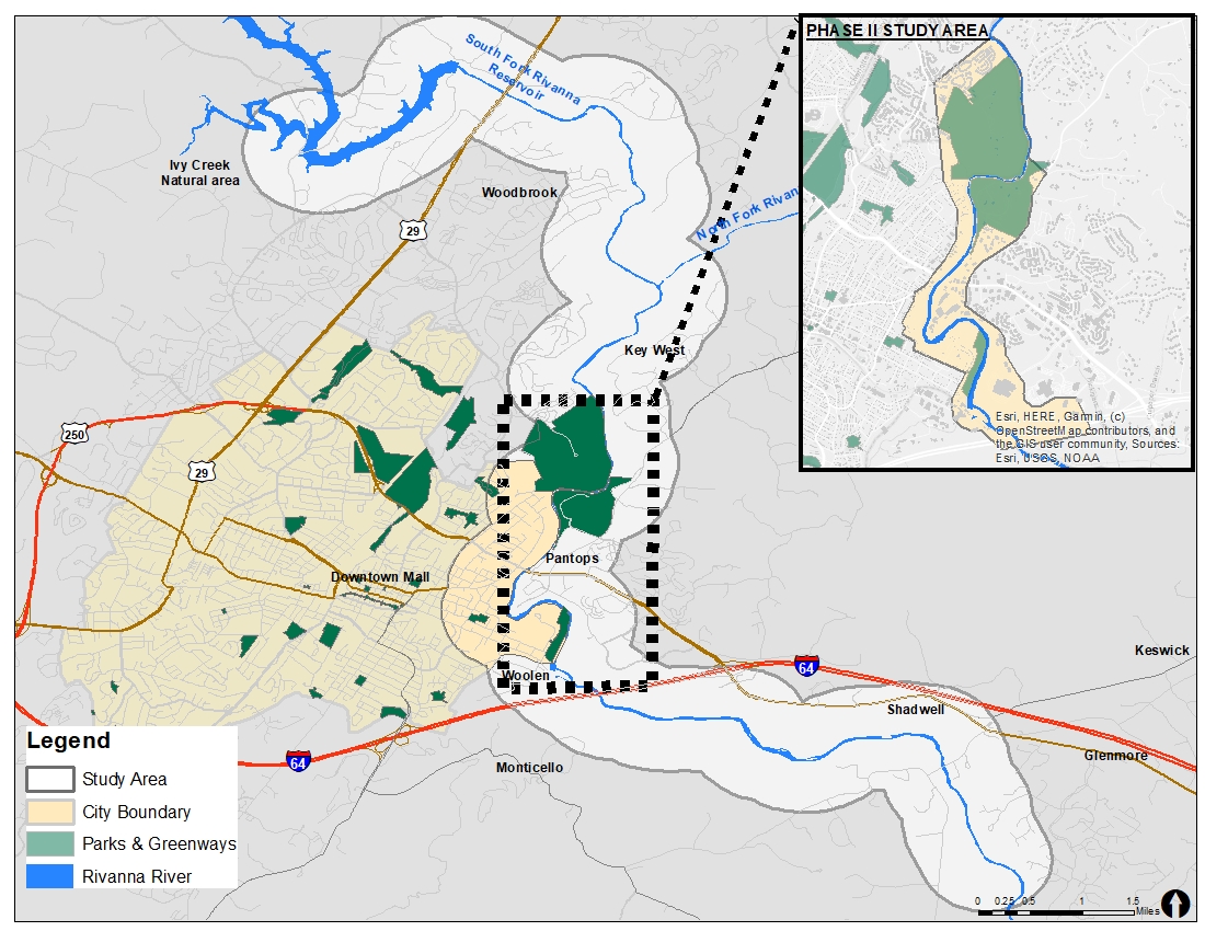
The Study Area
The study area consisted of the parcels adjacent to the Rivanna River from Darden Towe Park south to where I-64 crosses over the Rivanna.
Phase I
- A comprehensive series of thematic maps that illustrate existing conditions and critical issues along the River,
- This webpage, to share information and serve as a public engagement portal,
- Coordination between local officials and stakeholders,
- A Final Report on mapping and data gathering from Phase I, and
- A written proposal and budget for the Phase II Master Plan.
Phase II
- Livability: Coordinate both localities and other stakeholders, to foster a cleaner, safer, and more livable waterway;
- Investment: Serve as a catalyst for future economic investment within the corridor;
- Capital: Identify public capital in recreation facilitates and infrastructure;
- Policies: Inform any needed updates to City and County policies;
- Laws: Identify needed changes in local ordinances and codes;
- Programs: Guide the development of local programs designed to preserve environmental and historic river resources, while fostering future investment;
- Cooperation: Improve cooperation between the City of Charlottesville and Albemarle County.